Detail on OpenStreetMap
Published:
The OpenStreetMap data model allows for far more detail than would ever be useful to be recorded. For different people, different levels of detail are going to be useful and sometimes it can be hard to decide how much detail to record when out surveying.
Obviously, the less detail you record the wider the area you can cover, so there’s one trade-off you can consider straight away. In more densely populated areas, you’re likely not to be the only person mapping and so you can distribute the workload and tackle higher detail in smaller areas.
In lesser populated areas though, should you just not record detail on the map because it would be inconsistent with the levels of detail around it?
I was then led to the concept of cartographic generalisation, I kind of “artistic license” for cartographers. OpenStreetMap will omit details at certain zoom levels, and I’m not sure how these decisions are made as to what to omit, but perhaps if there was some record of the level of detail in objects, this could be factored into the equation.
The problem is not so much the level of detail, but the lack of record of the accuracy of that detail. Take a look at this from Google Maps:
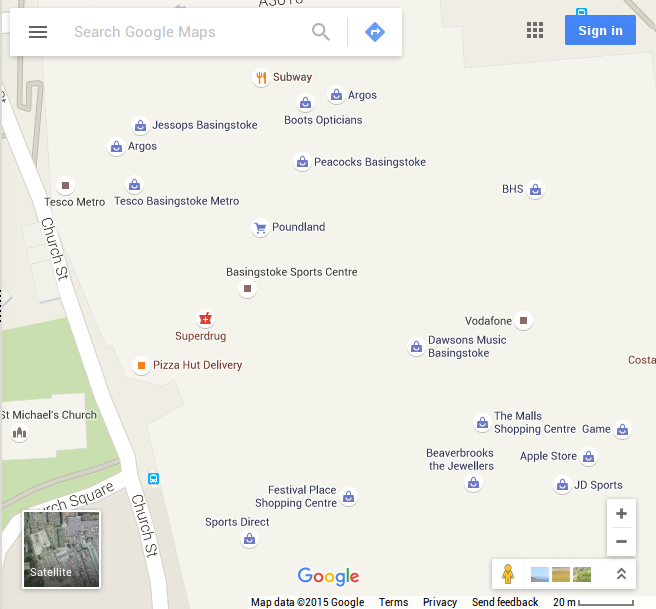
There’s a good selection of points here to represent the shops in the businesses in the Basingstoke town center. You’ll also notice that this is a complete mess, the accuracy of the points is assumed to be a lot higher by the map generation than it actually is.
Unless you have the detail, don’t pretend you do because it just makes the map less legible. For reference, here’s what OpenStreetMap looks like in this area now that I’ve surveyed it:
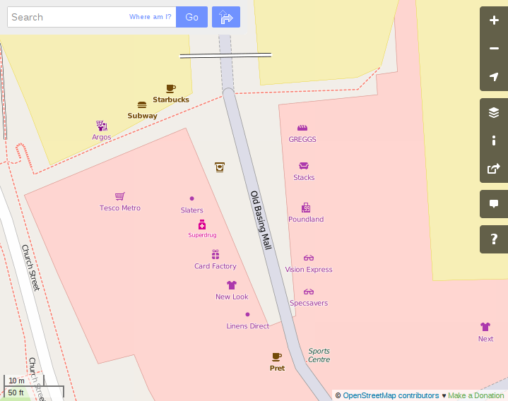
Now it makes sense to display those businesses on the map, because the accuracy is at a good level to produce a map with that level of detail.
Had the paths not been entered into the map, and the building outline for the shopping center, the detail of the businesses would have looked out of place though.
I guess what it comes down to, is if there’s not existing detail of the larger scale features like building outlines or pathways in the area you’re mapping, work on those first and add the extra detail later. Having the extra detail in the map is nice, but if it comes at the expense of map legibility then you have to question its worth.